back in cowtown
Got back last night around 3:30 am. Very very busy today, and will be tomorrow. Here's why I'm in town:
1) Process some samples (this avoids the mad fall rush when the sedimentologists bring in 1500 samples each and need thin sections)
2) Get more maps
3) Give my supervisors more than $3000 in receipts so I can get the money back and placate the good folks at VISA. (1663.70 in camping/field gear, 846.99 in food, 199.50 in lodgings (motel/campsite when in Revelstoke), and $300.16 in maps/airphotos).
4) Replace broken compasses
5) Acquire more stuff (inclinometer, altimeter, ice axe for Cory)
6) Write up a ridiculous time-wasting "occupational health and safety" report for the nervous office types and their lawyers, detailing our summer schedule (I'll make it up), daily workloads, our safety equipment, and a list of potential risks and how we plan to mitigate them. Obviously I'll flood the list with highly improbable risks in an annoying yet amusing attempt to comment on the ridiculousness of this exercise.
Our safety is and has always been paramount, and myself and my field assistant know exactly what to do in any situation. We have a nightly radio check-in with the summer caretaker at the CMH heli-skiing lodge, we have emergency radio frequencies for the operators at the Mica Dam, we have flares, thermal blankets, bear spray, rain coats, a serious mountain tent, at least 3 days of extra food every camp, extra gas, tons of bug stuff, gallons of sunscreen, and (soon) a shotgun. We carry rope, layers of warm clothes, lighters and matches, flashlights, ice axes, compasses, maps, and unreal numbers of granola and energy bars. We're more safe up there than the bloody idiots making us write this stuff up who drive a car in town every day.
Anyway, I'll write a detailed section on our contingency plan in case we run into Taliban. Steve very correctly pointed out that they hide in the mountains, and Osama may very well be up there (they've looked just about everywhere else). Obviously the plan will not involve calling up the US because they'd come in and bomb the friendly-fuck out of me and Cory, and Osama will probably get away.
Here's a nice pretty picture of the Soards Creek valley, where it hasn't been exploited by the logging companies. (Click on the photo... or perhaps even here for proper size.)
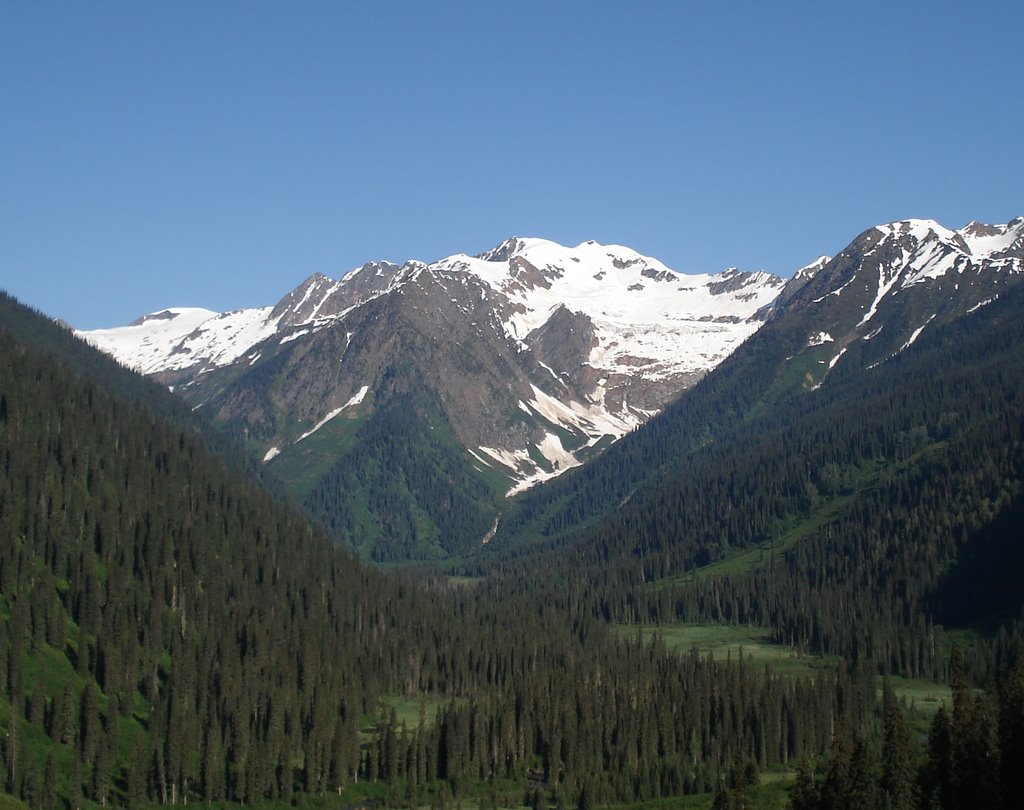 It certainly looks beautiful. It's just my little region of hellish mosquito-infested bog to map. Well okay... we won't be mapping in the valley at all. Little to no outcrop and terribly poor access... fighting through head high devil's club plants is slow, painful, pointless work. In that link note the poisonous nature of the nasty spines. My hands got a painful rash, but it's going away (next time will wear gloves).
In this shot Cory (my field assistant) is in thick ferns. I don't have a photo of the equally thick and deep devil's club.
 This is just to illustrate that what looks like a pretty open clear area compared to the deep forest is definitely not easy going. Half the time you can't see where your feet are going... not good when the ground has boulders and loose branches/trunks all over it.
Okay... that's enough. Unless I post tomorrow, or the day after, there will be nothing for a couple of weeks (unless no helicopters are available).
Cheers.
posted by Grumball at 8:47 PM
![]()


3 Comments:
Watch out for snakes; they make excellent shoes, I hear.
9:56 PM, June 29, 2006
I have been looking for sites like this for a long time. Thank you! » » »
6:07 AM, March 02, 2007
Excellent, love it! » » »
1:00 AM, March 07, 2007
Post a Comment
<< Home